
Fueled by unusually warm ocean waters in the tropical Pacific, El Niño conditions are developing and are set to influence global temperature and rainfall patterns, increasing the risk of extreme weather over the coming months.
A new El Niño/La Niña Update from the World Meteorological Organization (WMO) indicates an 80% likelihood of an El Niño event during June-August 2026. Probabilities for this to continue until at least November are near or above 90%. Although some uncertainty remains about El Niño peak strength and timing, most forecast models suggest it will be at least moderate—and possibly strong.
In late April to mid-May, the sea-surface temperature in the central-eastern Equatorial Pacific—the area used as a monitoring reference—was approaching El Niño thresholds, according to observations from different platforms used by WMO. These increasing surface anomalies are being fed by unusually warm subsurface conditions across the tropical Pacific, with temperatures exceeding 6°C above average and providing a substantial reservoir of heat that is contributing to the observed surface warming. Meanwhile, the Southern Oscillation Index—the atmospheric component of El Niño—is also consistent with developing El Niño conditions.
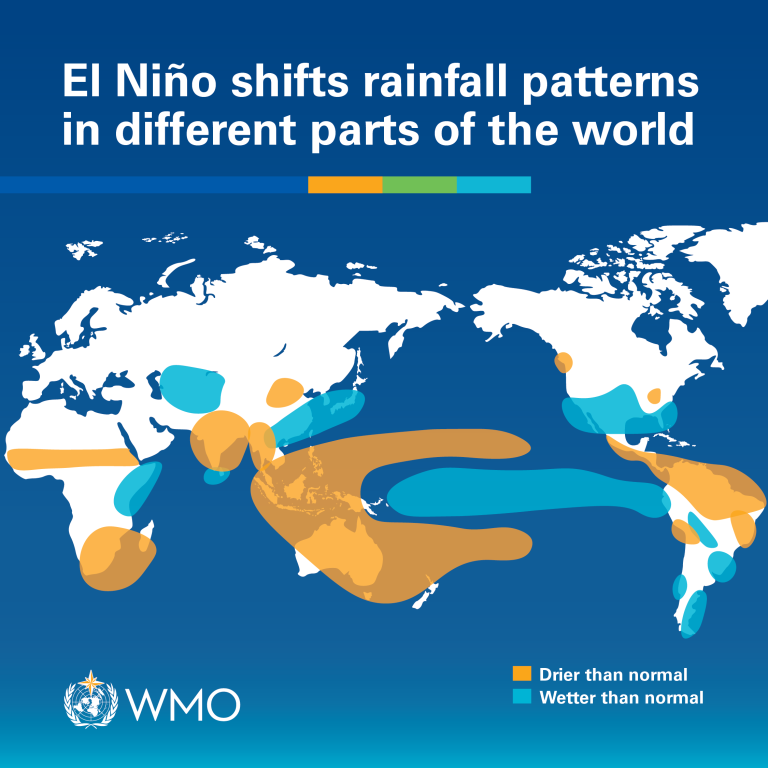
Typical Impacts
Each El Niño event is unique in terms of its evolution, spatial pattern and impacts. However, it is typically associated with increased rainfall in parts of southern South America, the southern United States, parts of the Horn of Africa and central Asia, and drier conditions over Central America, northern South America, the Caribbean, Australia, Indonesia and parts of southern Asia.
During the Boreal summer, El Niño’s warm water can fuel hurricanes in the central/eastern Pacific Ocean, while it hinders hurricane formation in the Atlantic Basin. The US National Oceanic and Atmospheric Administration (NOAA) is forecasting a below-normal hurricane season for the Atlantic basin this year. The Greater Horn of Africa Climate Outlook Forum (GHACOF) predicts a high likelihood of below-normal rainfall across much of the northern Greater Horn of Africa during the critical June-September rainy season. Similarly, South Asia is expected to receive below average monsoon rainfall, according to the South Asian Climate Outlook Forum. The Central America region expects drier and warmer conditions, according to the Central America Climate Outlook Forum.
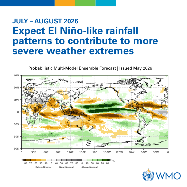
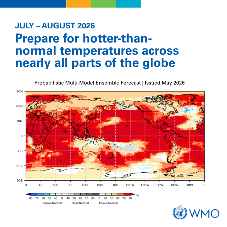
Global Seasonal Climate Update
WMO also issued a complementary Global Seasonal Climate Update which takes into account ENSO and other key climate drivers. For the June-July-August season, forecasts project a nearly universal dominance of above-normal temperatures in nearly all parts of the globe. These increase risks of heat stress and compounding hazards in some regions and accelerate the development of drought conditions where rainfall is reduced. Rainfall probabilities are typical of El Niño patterns and this is likely to contribute to a greater probability of extremes (e.g. increased rainfall and flooding, as well as drier conditions and droughts.
Images: World Meteorological Organization.
WMO El Niño/La Niña Updates are are based on a consensus of models from WMO Global Producing Centres, experts from National Meteorological and Hydrological Services and climate prediction centres around the world and are produced through a collaborative effort between the WMO and the International Research Institute for Climate and Society (IRI).